Horror Of California Wildfires Captured In Satellite And Aerial Photos
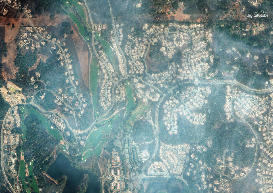
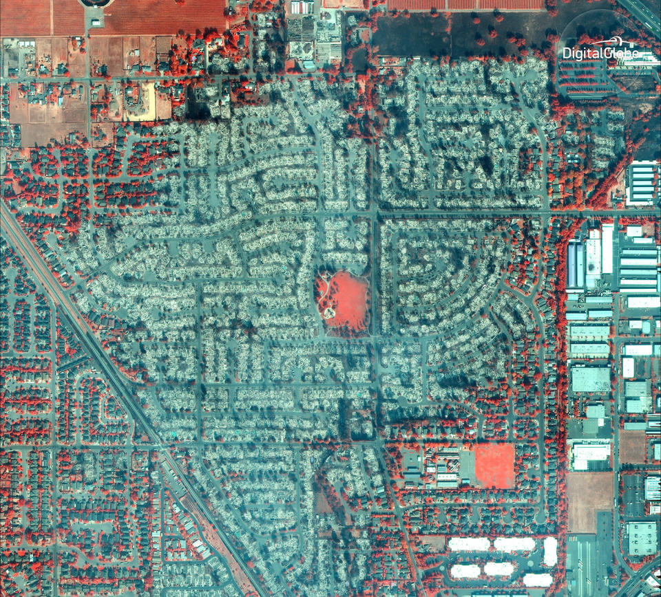
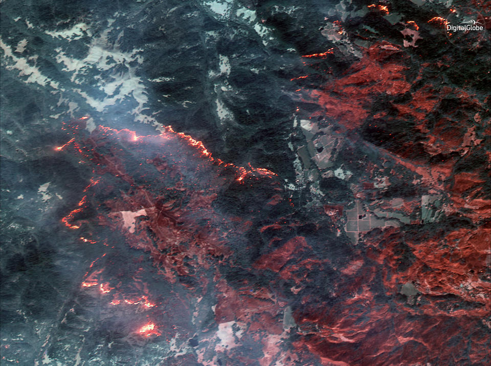
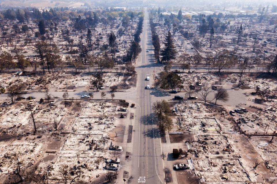
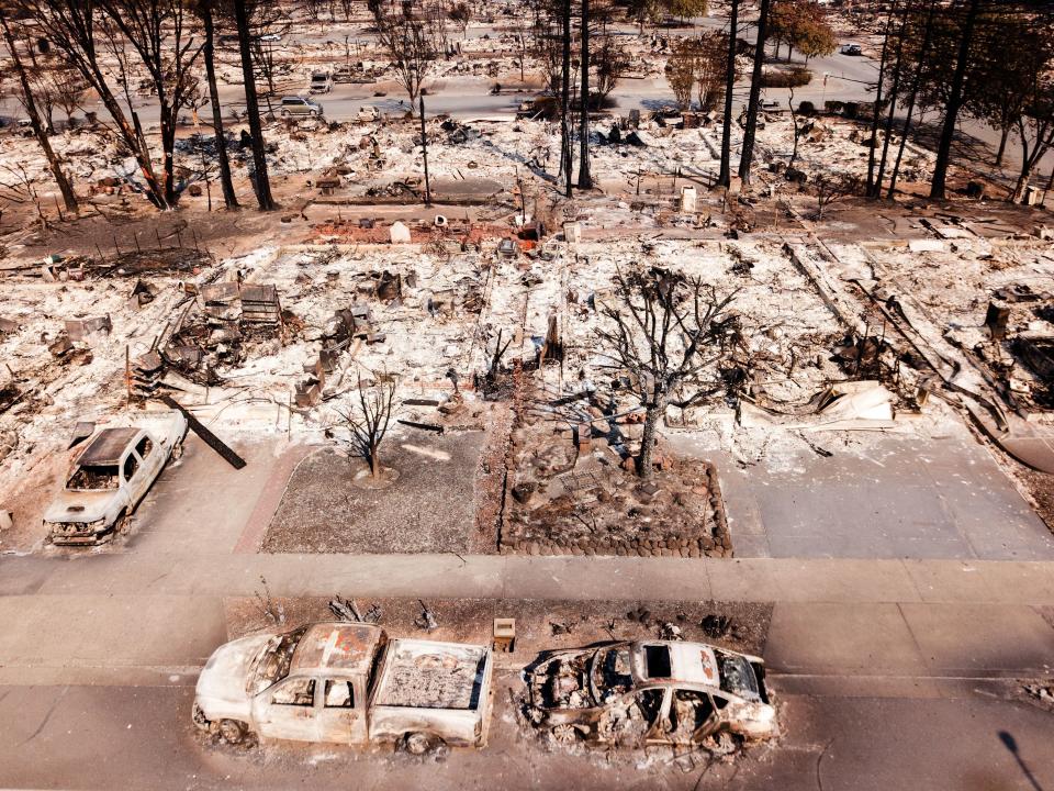
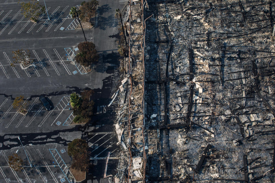
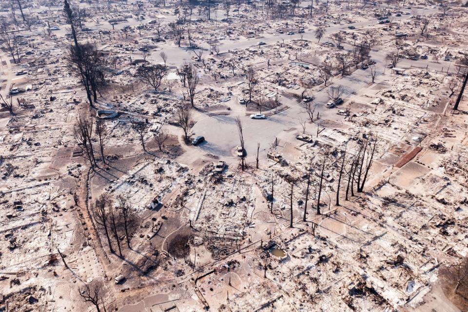
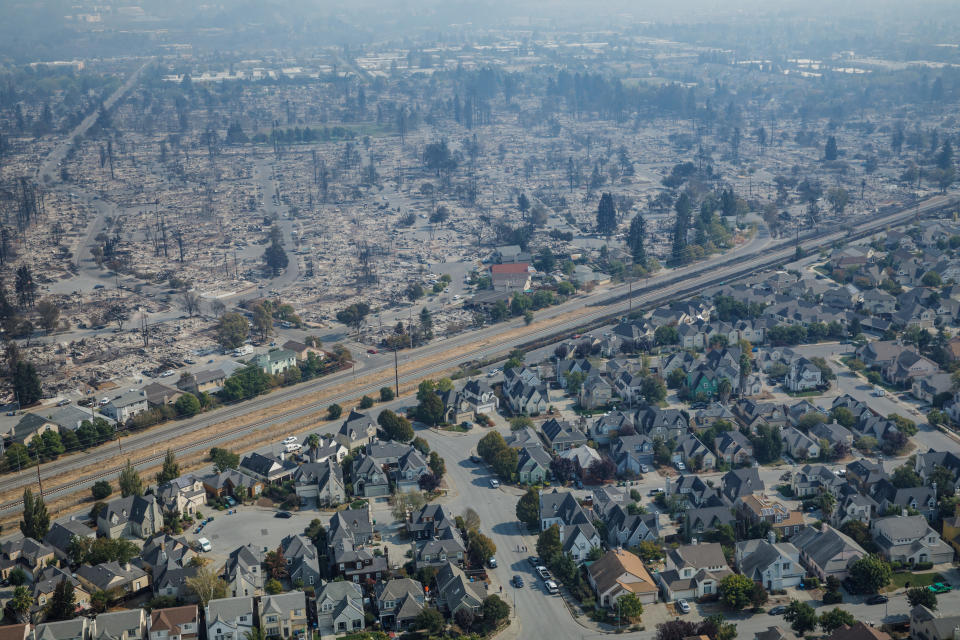
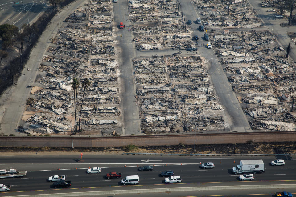
Wildfires have wrought almost unimaginable destruction this week across Northern California, where more than 8,000 firefighters are currently battling 21 blazes that have so far devastated 191,437 acres, killed at least 23 people and consumed around 3,500 buildings.
Strong winds on Wednesday night and Thursday morning have made a bad situation even worse, Sonoma County Sheriff’s Office spokesman Sgt. Spencer Crum told HuffPost. Many of the fires are less than 5 percent contained.
“I’ve been in the fire service for over 30 years, and I’m horrified at what I’ve seen,” Cal Fire public information officer Jerry Fernandez, who grew up in the Sonoma area, told HuffPost Wednesday. “We are at the worst conditions you could have right now.”
Satellite image provider DigitalGlobe captured pictures of the affected area on Tuesday and Wednesday of this week, sometimes using an infrared sensor to peer through the otherwise visually impenetrable smoke. The infrared satellite images below show the remaining healthy vegetation as red among the burned areas.
Here’s how you can help those affected by the fires.


Love HuffPost? Become a founding member of HuffPost Plus today.
This article originally appeared on HuffPost.
