Aerial Imaging Market to Worth $36.70 Billion by 2029 | Exclusive Report by Fortune Business Insights™
The aerial imaging market covered major Segments By Camera Orientation (Oblique and Vertical), By Oblique (Low and High), End-Use (Government, Defense, Forestry and Agriculture, and Others {Infrastructure, Transport, Media and Entertainment}) and Major Regions.
Aerial Imaging Market
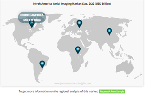
Pune, India, Oct. 30, 2023 (GLOBE NEWSWIRE) -- The global aerial imaging market size was USD 5.88 billion in 2022 and is projected to grow from USD 7.51 billion in 2023 to USD 36.70 billion in 2029 exhibiting a CAGR of 25.44% during the forecast period.
This information is presented by Fortune Business Insights™, in its report titled, “Aerial Imaging Market, 2023-2029.”
The aerial imaging market encompasses the acquisition and analysis of images and data captured from aerial platforms. It finds applications in agriculture, construction, infrastructure development, environmental monitoring, and more.
Aerial imaging finds applications in various industries, including agriculture, construction, oil and gas, forestry, real estate, and infrastructure development. The need for accurate and up-to-date spatial data for planning, analysis, and decision-making processes is driving the demand for aerial imaging solutions.
Get a Sample Research Report:
https://www.fortunebusinessinsights.com/enquiry/request-sample-pdf/aerial-imaging-market-100069
List of Key Players Profiled in the Aerial Imaging Market Report:
Nearmap Inc. (U.S.)
EagleView Technologies Inc. (U.S.)
Cooper Aerial Surveys Co (U.S.)
Vexcel Imaging Inc. (U.S.)
Fugro N.V (Netherlands)
AgEagle Aerial Systems Inc. (U.S.)
Dronegenuity Inc. (U.S.)
Ceres Imaging Inc (U.S.)
Geovantage Inc (U.S.)
Dronedeploy Inc. (U.S.)
Report Scope and Segmentation-
Report Coverage | Details |
Forecast Period | 2023-2029 |
Forecast CAGR | 25.44% |
2029 Value Projection | USD 36.70 billion |
Market Size in 2023 | USD 7.51 Billion |
Historical Data | 2018 - 2020 |
No. of Pages | 170 |
Report Coverage | Revenue Forecast, Company Profiles, Competitive Landscape, Growth Factors and Latest Trends |
Segments Covered |
|
Regions Covered |
|
Aerial Imaging Market Growth Drivers | Rising Demand for Surveillance in the Government and Defense Sectors Will Propel the Growth of the Market |
Increasing Demand for Aerial Imagery in Oil and Gas and Construction Drive Market Growth |
Browse Detailed Summary of Research Report with TOC:
https://www.fortunebusinessinsights.com/industry-reports/aerial-imaging-market-100069
Applications:
Agriculture: Aerial imaging is used for crop monitoring, disease detection, yield prediction, and precision agriculture.
Real Estate: It's used for property assessment, site selection, and showcasing properties.
Construction and Infrastructure: Aerial imagery helps with site planning, progress monitoring, and project management.
Environmental Monitoring: It's used for tracking deforestation, wildlife monitoring, and assessing natural disasters.
Urban Planning: Aerial images assist in city planning, traffic management, and land-use analysis.
Segmentation
Vertical Aerial Imaging Segment Held the Highest Share in 2021 Due to Growth in Various Mapping Related Applications
Based on the camera orientation, the market is classified into vertical and oblique
In terms of camera orientation, the global market is categorized into oblique and vertical.
The oblique segment held a higher market share and is projected to grow with the highest growth rate during the forecast period.
Low Oblique Segment Will Showcase Remarkable Growth Due to Rising Demand for Real Estate and Other Applications
By Oblique, the market is divided into Low and High Oblique.
Oblique aerial photographs provide the viewer with a comprehensible image of a location and is useful for looking at foreground building frontages.
The Low Oblique segment will grow with the highest CAGR during the forecast period.
Growing Use of Aerial Imaging by the Governments in Different Countries to Drive the Growth of the Market
Based on End-Use, the market is classified into Government, Defense, Forestry and Agriculture and Others (Infrastructure, Transport, Media, and Entertainment)
The Government segment is set to grow at the highest CAGR during the forecasted period.
The global aerial imaging market has been segmented into North America, Europe, Asia Pacific and the Rest of the World.
Aerial imaging data is often integrated with Geographic Information Systems (GIS) and remote sensing technologies to analyze and extract valuable information. The integration of aerial imagery with these technologies enhances spatial analysis capabilities and decision-making processes.
Get a Quote Now:
https://www.fortunebusinessinsights.com/enquiry/get-a-quote/aerial-imaging-market-100069
Report Coverage
The report offers a detailed study of the market and a keen examination of the major segments of the market. It provides an in-depth analysis of key players and their insightful strategies to spur market growth for monetary gains. It also shares tangible insights which guide business owners with their investment perspective. The regional dynamics and how they shape the market in an upward curve are presented in the following report. Moreover, COVID-19 impacts have been added for additional information and how it is expected to affect the demand for technology in the near future.
Driving Factors
Rising Demand for Surveillance in Government and Defense Sector Will Propel Market Growth
Due to the numerous uses for aerial imagery services, including the creation of topographic maps, surveillance, photogrammetric surveys, and others, their use has substantially increased over the past few years. The demand for aerial imagery has increased as a result of the expanding use of surveillance drones for applications in public, wildlife, and critical infrastructure safety and security.
Ask for Customization:
https://www.fortunebusinessinsights.com/enquiry/ask-for-customization/aerial-imaging-market-100069
Detailed Table of Contents:
Introduction
Research Scope
Market Segmentation
Research Methodology
Definitions and Assumptions
Executive Summary
Market Dynamics
Market Drivers
Market Restraints
Market Opportunities
Key Insights
Key Industry Developments – Key Contracts & Agreements, Mergers, Acquisitions and Partnerships
Latest technological Advancements
Porters Five Forces Analysis
Supply Chain Analysis
Quantitative Insights-Impact of COVID-19 Pandemic on Global Aerial Imaging Market
Impact of COVID-19 Pandemic on Global Aerial Imaging Market
Steps Taken by Industry/Companies/Government to Overcome the Impact
Key Development in the industry in Response to COVID-19 Pandemic
Potential Opportunities due to COVID-19 Outbreak
Global Aerial Imaging Market Analysis, Insights and Forecast, 2018-2029
Key Findings / Definitions
Market Analysis, Insights and Forecast – By Camera Orientation
Oblique
High Oblique
Low Oblique
Vertical
Market Analysis, Insights and Forecast – By End Use Industry
Government
Defense
Forestry and Agriculture
Others
Market Analysis, Insights and Forecast – By Region
North America
Europe
Asia-pacific
Rest of the world
TOC Continued...!
Inquiry Before Buying:
https://www.fortunebusinessinsights.com/enquiry/queries/aerial-imaging-market-100069
Regional Insights
North America to Hold Dominant Share Backed by Increasing Adoption of Technology
The aerial imaging market in North America, which accounted for the highest share in 2021, is anticipated to expand at a moderate CAGR over the expected period. Due to the region's thriving trade, economy, and presence of significant industries, this expansion is ascribed to the rising use of aerial images in the U.S. and Canada.
Due to the demand for aerial photography in the real estate and infrastructure sectors, Europe will have moderate development throughout the projection period. Due to the presence of large manufacturers and the usage of drones in the agriculture sector, this rise is ascribed to demand for use in nations like the United Kingdom, Germany, France, and others.
Competitive Landscape
Key Players Sign Significant Contracts to Make Remarkable Changes in Market
The players operating in the market often employ numerous tactics that will aid the market growth and product demand. Among the pool of strategies, one such notable strategy to expand the business prospect is signing multimillion contracts with government bodies and securing profitable revenue for their own company.
Speak to Our Expert:
https://www.fortunebusinessinsights.com/enquiry/speak-to-analyst/aerial-imaging-market-100069
Key Industry Development
June 2022: Energinetor awarded Fugro N.V a five-year contract for the collection of aerial and lidar imagery data for power transmission networks. For data collection, the company will employ a lightweight aircraft fitted with scanning technologies.
Read Related Insights:
Reusable Launch Vehicle Market to Be Worth USD 5.41 Billion By 2030; Increased Usage of High Payload Rockets to Drive Market Forward
LiDAR Drone Market is projected to grow USD 455.0 million by 2028, at a CAGR of 17.98%
Aero Wing Market Size to grow USD 20.35 billion in 2028 with exhibiting a CAGR of 8.98%
About Us:
Fortune Business Insights™ delivers accurate data and innovative corporate analysis, helping organizations of all sizes make appropriate decisions. We tailor novel solutions for our clients, assisting them to address various challenges distinct to their businesses. Our aim is to empower them with holistic market intelligence, providing a granular overview of the market they are operating in.
Address:
Fortune Business Insights Pvt. Ltd.
9th Floor, Icon Tower, Baner,
Mahalunge Road, Baner, Pune - 411045,
Maharashtra, India.
Phone:
US: +1 424 253 0390
UK: +44 2071 939123
APAC: +91 744 740 1245
Email: sales@fortunebusinessinsights.com
Follow Us: LinkedIn | Facebook | Twitter
Attachment

